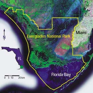
This Sunday wasn't the best. The National Park ranger thought us and showed us the satellite and topographic image of the park. The not best part of Sunday was that one thing i hate more is topographic maps. The park ranger gave all of the visitors a page with a satellite image and a topographic map. Like the one shown below.
"The Tides and Inflows in the Mangroves of the Everglades (TIME) Interdisciplinary Project of the South Florida Ecosystem Program." FS-031-01--The Tides and Inflows in the Mangroves of the Everglades (TIME) Interdisciplinary Project of the South Florida Ecosystem Program. N.p., n.d. Web. 15 May 2014.
 RSS Feed